 Website: http://www.ugeducation.ucla.edu/uei/beta/communitylearningengagingla.htm
Principal Investigator(s): Dr. Elizabeth Goodhue, UCLA Center for Community Learning
Website: http://www.ugeducation.ucla.edu/uei/beta/communitylearningengagingla.htm
Principal Investigator(s): Dr. Elizabeth Goodhue, UCLA Center for Community Learning
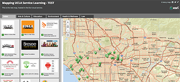
Service learning students at UCLA enroll in academic courses while they work in diverse communities throughout Los Angeles county, from adult daycare centers in the San Fernando Valley to after-school tutoring programs in Mar Vista, from homeless youth shelters in Hollywood to oral history archives in Chinatown. Moreover, students from multiple different courses work at all of these sites and have very different learning experiences depending on the disciplinary lens through which they approach their service learning. While the Center for Community Learning keeps records of where students work during particular courses, they have no comprehensive system for documenting the wide range of learning outcomes that students gain when they collaborate with community partners during various courses. They also have no comprehensive public database of service learning projects for faculty to access for inspiration when developing new courses or for students to access to get a better idea of what to expect when they enroll in a service learning course. To address these challenges, we are developing an interactive digital map of service learning partnerships using HyperCities and Google Maps / Google Earth. Objects pinned to this map will include descriptions of community partnerships and photos, as well as reflective writing from students, faculty, and community partners.